


A low tide walk on Morecambe Bay
With the Guide over Sands Trust

In medieval times, the treacherous sands of Morecambe Bay provided a risky shortcut for travellers, avoiding the much longer route around the shores. Potential dangers included becoming lost in mist, getting stuck in quicksand - which can set around your legs like concrete - and of course the tides, which are said to come in faster than a galloping horse.
Only the foolhardy would attempt the journey without a guide and that role was once performed by monks appointed by Cartmel and Conishead Priories. However, in 1548, following the dissolution of the monasteries by Henry VIII, the King’s Guide to the Sands was instituted as an official post appointed by the Duchy of Lancaster.
Walkers in the Leven Estuary with the Guide over Sands Trust, 2 June 2024
By the 19th century, wealthier travellers could make the trip by stagecoach and a September 1848 poster from Lancaster Maritime Museum advertises how Messrs Blaylock, Butcher & Co. could take you in horse-drawn comfort from Ulverston to Hest Bank near Morecambe in just two hours.
From Ulverston, the trip crossed the Leven Estuary first, then the Cartmel Peninsula, before rejoining the sands to cross the Kent Estuary, finally coming ashore again to stop at stables at the Hest Bank Inn, before continuing to Lancaster. Departure times advanced by about an hour each day with the tides, but within a decade the newly built coastal railway provided a faster and safer alternative.
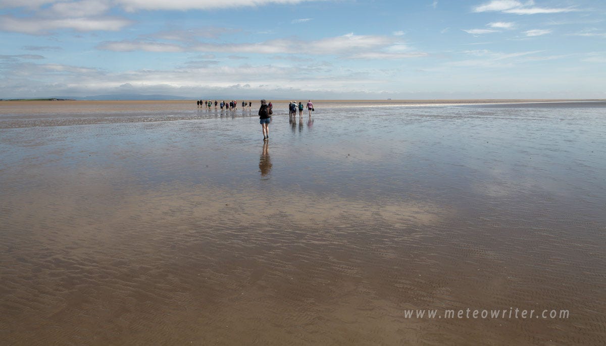
Nowadays the only safe way to cross the sands is on one of the trips organized by the Guide over Sands Trust. Having already done the first part of this ancient route across the Kent Estuary, I had long wanted to continue the trip across the Leven Estuary and last Sunday was the day. The Trust was established in 1877 and as well as appointing guides runs regular trips across both estuaries, which have raised millions of pounds for charities.
Our guide was Raymond Porter, who makes a living fishing out in the bay and has been leading the Leven crossings for years. After a short briefing, we set off along the shore, soon stepping out onto the sands, worn flat by the tides. Heading off at a good pace, the only obstacles were a few small streams to cross, our shoes soon drying out in the breeze. In places, ripples on the sand hinted at the direction of the flow, with just a few puddles remaining to splash through. Temporary posts in the sand indicated the route, which are placed shortly before the walk to check all is safe.
After about an hour, our first stop was at the remarkable sight of a stone wall in the estuary. This was Collins Weir, which reappeared from the sands in May 2024 for the first time in many years following a period of unusually high flows and heavy rainfall.
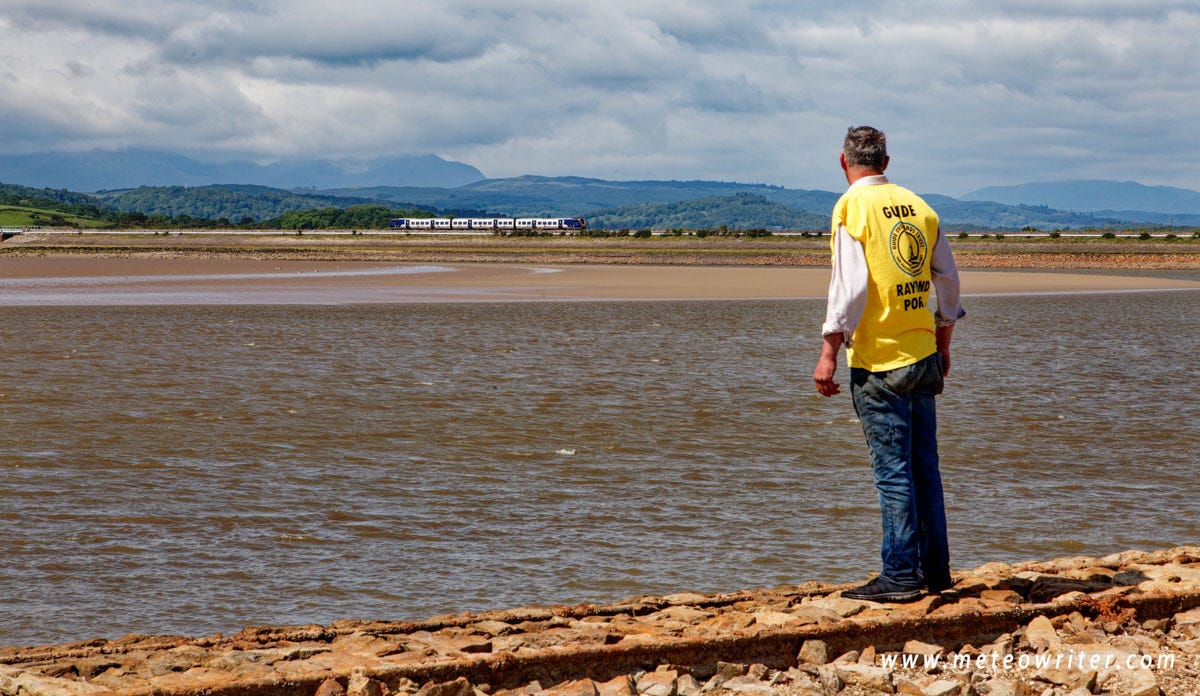
Raymond Porter at Collins Weir, with the coastal railway viaduct in the distance, 2 June 2024
Several hundred metres long, this was built in the 1840s in an unsuccessful attempt to keep the main channel of the Leven in check for shipping into the nearby Ulverston Canal, which led to Ulverston’s port, another victim of the railways. A short section remains, including the corroded metal tracks which workers once pushed carts along to build the wall, dumping stone at the end. The tracks would then be extended once the new section was high enough.
From there we then skirted a dangerous looking area of wet sand to head down the estuary toward another prominent feature, tree-covered Chapel Island, which at this time of year is out of bounds due to the many nesting birds, including a large population of eider ducks. Occasionally, flights of geese lifted off to head inland with herons and cormorants visible too.
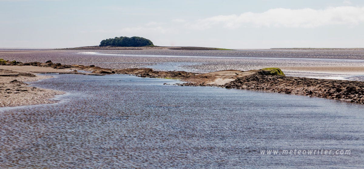
Chapel Island viewed from further upstream, 2 June 2024
Here we saw another consequence of the storms which is a new channel that has opened up on the east side of the island, meaning that, for now at least, it is completely surrounded by water even at low tide. This meant that the final part of the walk to Canal Foot wasn’t possible on this trip and instead we took a long looping walk back to the start point.
For me this final section was one of the highlights as for a while we seemed to be heading straight out to sea, across the desert-like expanse uncovered at low tide. It was a remarkable thought that in just a few hours this area would be covered in several metres of water (and the bay has the UK’s largest unbroken areas of sand exposed at low tide and one of the highest tidal ranges). Following some more easy stream crossings we arrived back at the shore about 2.5 hours after setting off, with time for a quick chat before heading back to the car.
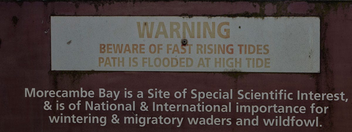
Part of a warning sign near the start of the walk
So that was the end of a great day out and if you are interested in making the walk yourself, trips run until August; see the Guide over Sands Trust website for more details. The Trust’s Arnside to Grange walk is another fascinating trip and of course estuary low tide walks aren’t just a UK phenomenon and you can find guided trips elsewhere, such as in the Bay of Fundy in Canada and to Mont St Michel in France.
Further reading
From the author
Spectacular Britain, Kevin Sene, Bloomsbury, 2024, for ideas for other low tide walks around the UK Link
The Cumbria and Lake District Coast, 2021, for places to visit, history and wildlife around the Cartmel peninsula and the Kent and Leven estuaries Link
General
Guide over Sands Trust Link
Tide-exposed embankment ‘is like finding Atlantis’, BBC, 10 May 2024 Link
I enjoyed your description of the walk. Thank you. I must the Holy Island causeway soon which is near me.
Fascinating. I’ve done Arnside—Kents Bank four times but never done the Leven Sands.